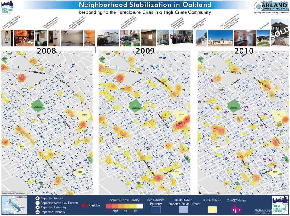
Neighborhood Stabilization in Oakland Poster
The following description was submitted by the entrant:
East Oakland has faced multiple crises over the past decades.
Specifically, issues such as heavy disinvestment from the mid-century, to spiraling crime, consistently high unemployment and failing public school systems are still present. On top of this, long-term stress for the part of the city referred to in the maps are from the predatory lending of the early 2000's; and this has further resulted in massive foreclosures across an area with historically stable home ownership.
In 2009, the Urban Strategies Council and key allies formed the Oakland Community Land Trust in an effort to stabilize these communities. The model used combines very detailed neighborhood-level data on crime, assets, foreclosures and housing conditions to ensure work is data-driven and proactive.
This map illustrates the growing burden of the foreclosure crisis in Oakland over time. It also shows the changes in stability and serious crimes in this neighborhood that make neighborhood stabilization efforts even more difficult. When considering which foreclosed properties to acquire and rehabilitate (for moderate income affordable housing), it is crucial that there be consideration for the neighborhood context of each property. For example, homes on gang occupied corners or on streets known for shootouts, present serious challenges in attracting new home owners. Likewise, an area with high property crime may result in increased construction costs due to building-site thefts.


